Monte Cavo and La Via Sacra
Want to go for a walk, have a “forest bath”, learn a little history and take in one of the most impressive views found in the Castellli Romani? Then head to Monte Cavo and La Via Sacra (the Sacred road)
Located in the municipality of Rocca di Papa, the mountain Monte Cavo is the second highest peak of the Colli Albani (Alban hills) at 949M.
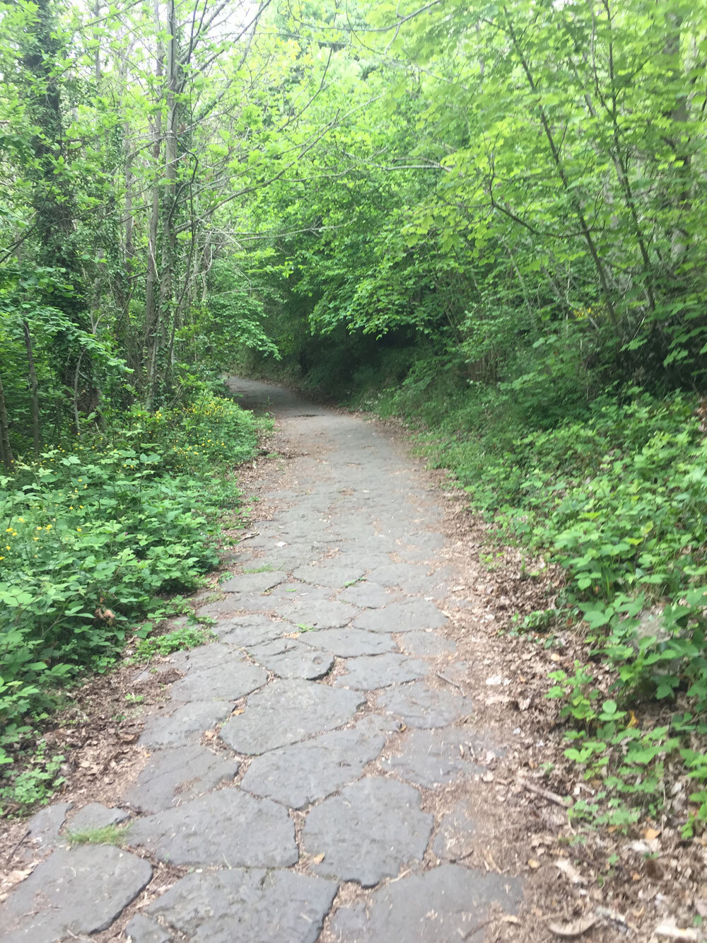
It is scaled by walking on a Roman road of volcanic stone, still very much intact, called Via Sacra.
In certain areas, you can also see "crepidines", ancient curbs made of peperino stone. The road was built in the 7th century BC to lead to the once existing Temple of Jupiter Latiaris.
The ascension is not too terribly difficult as you are climbing only 300 m of the total 949m ; tackle it by taking your time.* My two children, ages 10 and 12, and I took a moderate pace going up. No chance of getting lost; follow the Roman road which leads you to the panoramic terrace.
In spring, the scent of spring and wild flowers fill the air and many types of flora can be observed along the route, while in autumn it is the ideal time to admire the fall foliage and chestnuts.
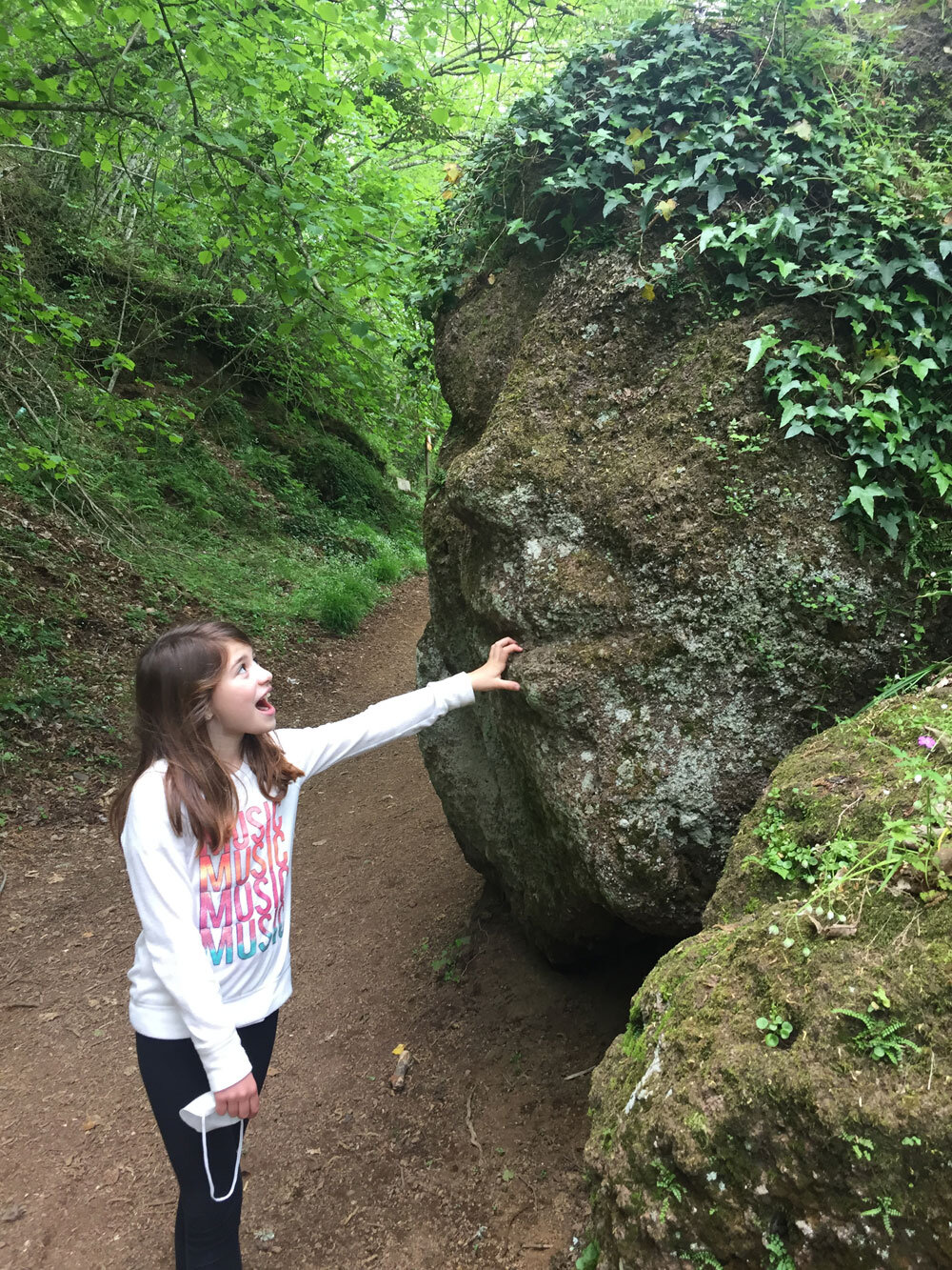
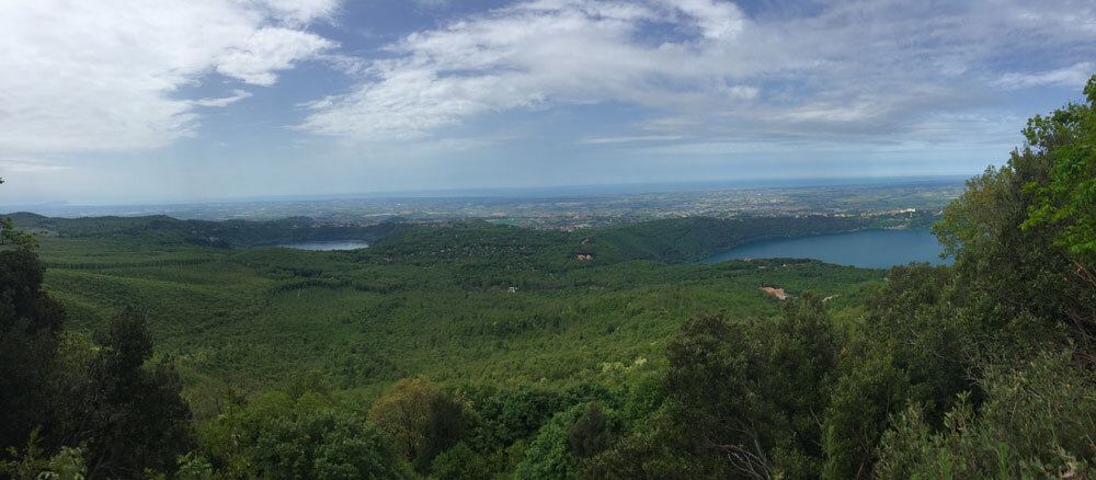
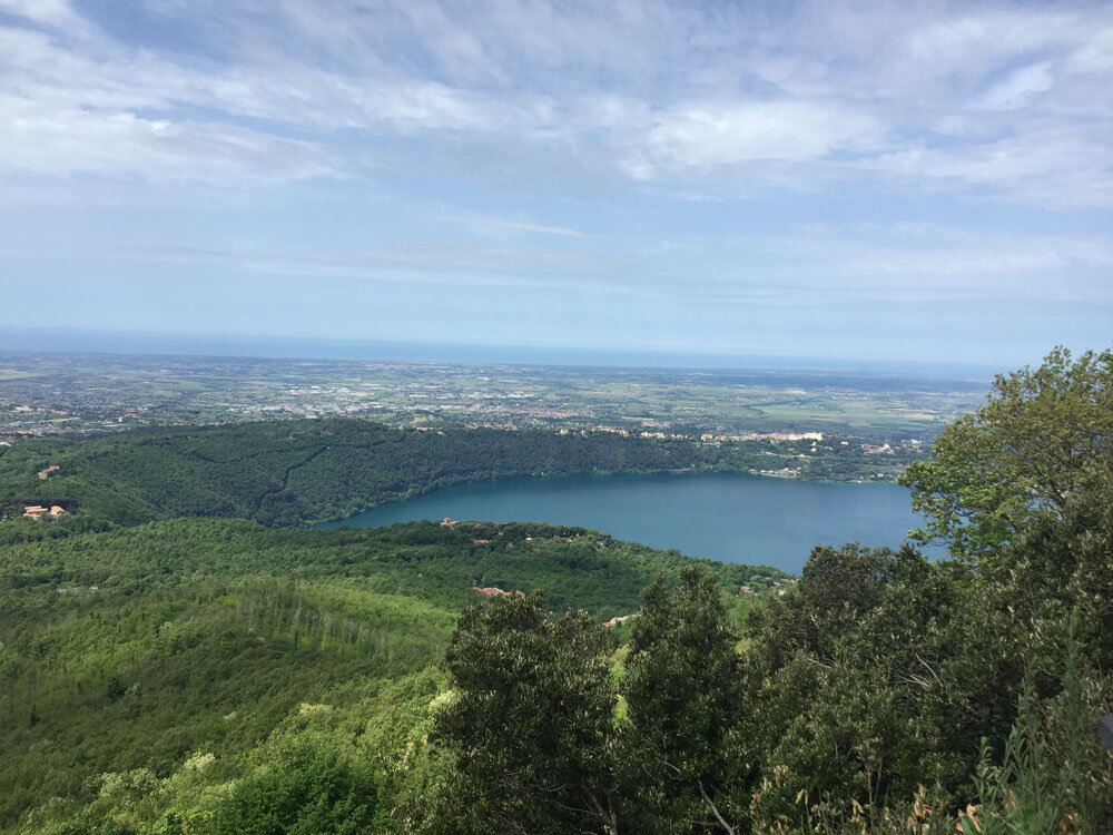
Right before you reach the top, you come across the Edicola Sacra di S. Rita (aedicule) and rock statues of a face and what remains of a bull. This all builds up to the main highlight, the panoramic terrace at the top, offering a fantastic view of both lakes Nemi and Albano, with the Mediterranean sea behind them on the horizon.
Continuing further up the path, you reach a military zone and unsightly antenna towers. At this point, you can turn back and retace your steps to your car or proceed on other trails.
Arrive and parking:
As there are a few ways and trails to arrive to La via Sacra, it can be confusing on how to get there. Here are some indications:
From via dei Laghi heads towards Rocca di Papa on via Ariccia (SR2018). After 1Km turn right on via Scalette and:
a) Park as soon as you turn on via Scalette. It is possible to park on both sides of the street here and start your accent, the first part on the asphalt road.
or
b) Continue driving further on this road, which significantly narrows to one lane, for 1.6km. The beginning of the Roman path will be on your left, as well as a few parking spots along the asphalt road.
OR
c) From the main parking lot in Rocca di Papa, Parcheggio Campi di Annibali, walk up via Monte Cavo Campagna. It's a 15-20 minute walk to the top.
Public Transport:
From Rome - Cotral buses leaving from Anagnina go to Rocca di Papa center.
*Time and level of difficulty
The walk takes approximately 1.30-2.30 hours depending on your speed and starting point (a & b above) or 30 minutes round trip with starting point c, Those with walking difficulties or small children may find this walk difficult.
If you want to check out the view, without a great deal of walking, you can. Park your car near the military area on via Scallette and take the short walk down to the panoramic terrace.
There are also alternative routes within the park with varying levels of difficulty, such as path 509 or 512. Check out all the routes here.
Other notes
Dogs are allowed. The route is popular with mountain bikers. Bring your own refreshments, especially water, as there are no fountains on the route.
First published: Summer 2020
Latest update: May 5, 2021
Located in the municipality of Rocca di Papa, the mountain Monte Cavo is the second highest peak of the Colli Albani (Alban hills) at 949M.
It is scaled by walking on a Roman road of volcanic stone, still very much intact, called Via Sacra.
In certain areas, you can also see "crepidines", ancient curbs made of peperino stone. The road was built in the 7th century BC to lead to the once existing Temple of Jupiter Latiaris.
The ascension is not too terribly difficult as you are climbing only 300 m of the total 949m ; tackle it by taking your time.* My two children, ages 10 and 12, and I took a moderate pace going up. No chance of getting lost; follow the Roman road which leads you to the panoramic terrace.
In spring, the scent of spring and wild flowers fill the air and many types of flora can be observed along the route, while in autumn it is the ideal time to admire the fall foliage and chestnuts.
Right before you reach the top, you come across the Edicola Sacra di S. Rita (aedicule) and rock statues of a face and what remains of a bull. This all builds up to the main highlight, the panoramic terrace at the top, offering a fantastic view of both lakes Nemi and Albano, with the Mediterranean sea behind them on the horizon.
Continuing further up the path, you reach a military zone and unsightly antenna towers. At this point, you can turn back and retace your steps to your car or proceed on other trails.
Arrive and parking:
As there are a few ways and trails to arrive to La via Sacra, it can be confusing on how to get there. Here are some indications:
From via dei Laghi heads towards Rocca di Papa on via Ariccia (SR2018). After 1Km turn right on via Scalette and:
a) Park as soon as you turn on via Scalette. It is possible to park on both sides of the street here and start your accent, the first part on the asphalt road.
or
b) Continue driving further on this road, which significantly narrows to one lane, for 1.6km. The beginning of the Roman path will be on your left, as well as a few parking spots along the asphalt road.
OR
c) From the main parking lot in Rocca di Papa, Parcheggio Campi di Annibali, walk up via Monte Cavo Campagna. It's a 15-20 minute walk to the top.
Public Transport:
From Rome - Cotral buses leaving from Anagnina go to Rocca di Papa center.
*Time and level of difficulty
The walk takes approximately 1.30-2.30 hours depending on your speed and starting point (a & b above) or 30 minutes round trip with starting point c, Those with walking difficulties or small children may find this walk difficult.
If you want to check out the view, without a great deal of walking, you can. Park your car near the military area on via Scallette and take the short walk down to the panoramic terrace.
There are also alternative routes within the park with varying levels of difficulty, such as path 509 or 512. Check out all the routes here.
Other notes
Dogs are allowed. The route is popular with mountain bikers. Bring your own refreshments, especially water, as there are no fountains on the route.
First published: Summer 2020
Latest update: May 5, 2021
Share this page